Dam or Levee Failure
Data Limitations
The tools below do not provide dam or levee failure information but rather information on the locations of and pertinent details about dams and levees in Texas. The dam inventory is limited to dams with a height of at least 25 feet and which exceed 15 acre-feet in storage, or those with a height of at least six feet and 50 acre-feet of storage unless the dam is classified as high hazard potential. The high hazard potential dam is a dam where failure will probably cause loss of human life regardless of the physical condition of the structure.
Definition and Description
Catastrophic type of failure characterized by the sudden, rapid, and uncontrolled release of impounded water or the likelihood of such an uncontrolled release. It is recognized that there are lesser degrees of failure and that any malfunction or abnormality outside the design assumptions and parameters that adversely affect a dam’s primary function of impounding water is properly considered a failure. These lesser degrees of failure can progressively lead to or heighten the risk of a catastrophic failure. They are, however, normally amenable to corrective action (USSD 2018).
Dams help address the complex challenge of controlling and distributing water. They have been recognized as a key water management practice dating back to early civilizations of the Americas, ancient Egypt, and China. As water is a part of the hydrologic cycle, dams work to conserve water through reservoirs to prohibit flow back to the ocean. With the advancement of civilization and a growing population, water withheld in such reservoirs are an integral part of society and is a necessary source for energy, drinking water, irrigation practices, etc. Dams also protect areas of development and civilization from floods through flood control measures. Dam safety and maintenance standards have increased over time.
Historical Data
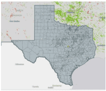
National Inventory of Dams by State
(1900-present) U.S. Army Corps of EngineersThis tool provides you with an overview of the dams in Texas, including the number by hazard potential, height, owner type, primary type, primary purpose, and completion date.
1. Scroll down until you see a map. On the drop-down menu to the left of the map, select Texas. For specific counties, you can then select a county within Texas from the same menu or click on the map after Texas is selected. 2. The map then zooms in to Texas and shows all dam locations. A summary of dams in the state is visible above the map. 3. To view dams by hazard potential, click the Layer Controls button on the top left of the map, then click Categorize by and choose Dams by Hazard Potential. The number of dams in each category are shown under the map. Other categories can be mapped as well. 4. Click Browse These Dams above the map to access a list of dams with more information.
National Inventory of Dams Interactive Report
(1900-present)U.S. Army Corps of EngineersThis report allows you to view the details of individual dams within the state of Texas.
1. At the top of the page, click on the Advanced Search tab. 2. On the top left of the page in the Location box, select State for the Geography Type, then type Texas in the space below. Click UPDATE RESULTS above this area. 3. Click the DAM DETAILS tab near the top of the page to access a chart of all Texas dams and associated information. 4. Choose which columns to display by clicking Columns, then select/de-select the columns as needed. 5. To sort by column, click the arrow to the right of the column header. Note: You can narrow results by selecting additional options on the left of the page (such as Hazard Potential Classification to view high hazard dams). Click UPDATE RESULTS for any changes made to update the list.

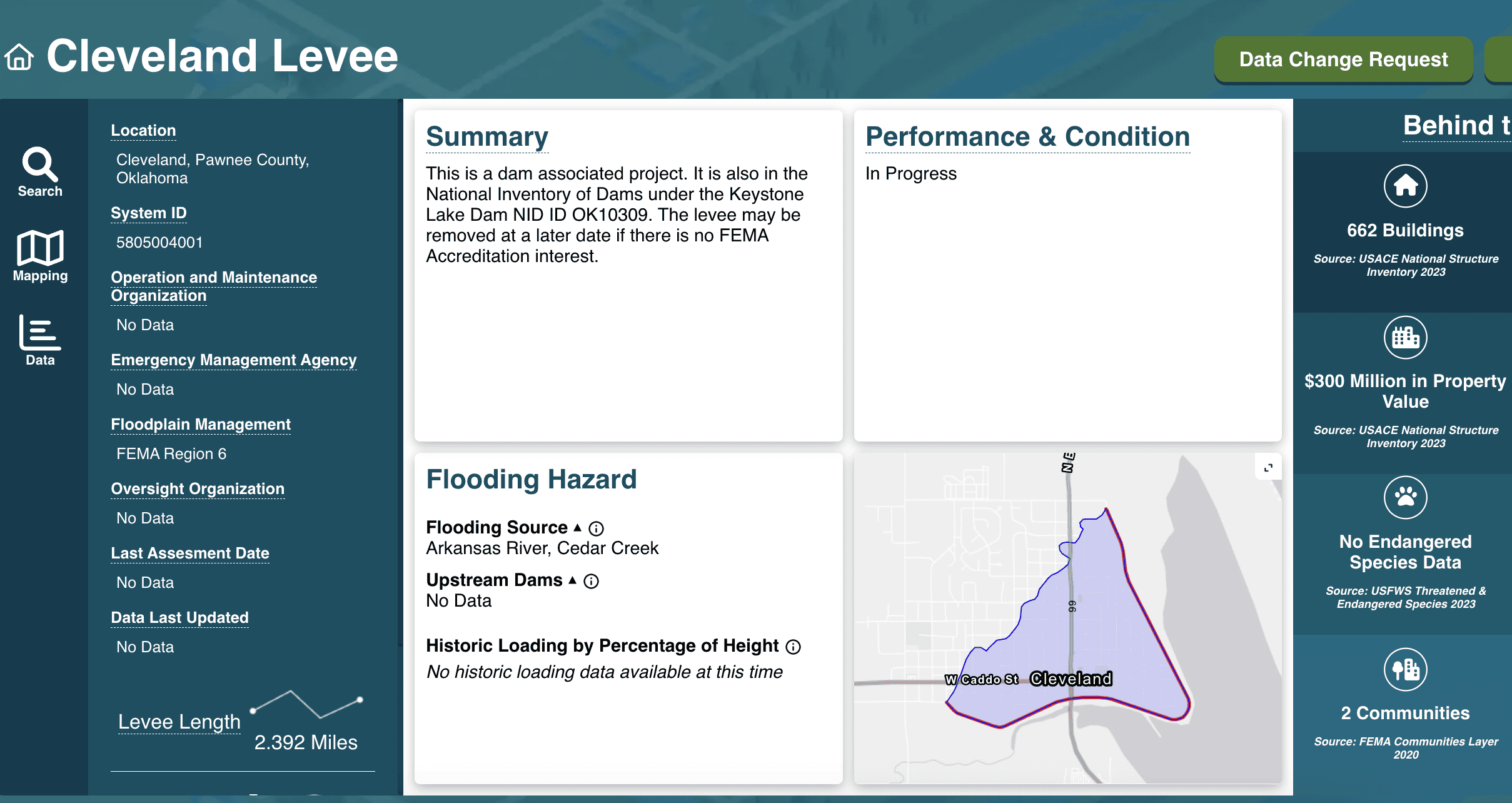
National Levee Database
(Levee Inventory: 1882- present) U.S. Army Corps of EngineersThis tool allows you to to explore levees in your area, including location, year constructed, length, number of people and structures at risk should failure occur, property values in the risk area, and more.
1. In the search bar, type Texas or a city, county, address, or levee name. After you type the location or levee name, click the selection from the dropdown menu. 2. The next page shows a map of levees in your selected area and a list of levees on the lefthand side. Click the levee from the list or on the map. If you select the levee from the map, then click it again in the Select a Levee System popup box when it appears. 3. The results page includes information about the levee, including a summary, performance and condition, a map, and the flooding hazard. The Behind the Levee section on the right includes consequence information (e.g., infrastructure, population, property values). Mouse over the squares to see more information.
Climate Change Trends
Increases in extreme rainfall (Easterling et al. 2017) may increase the likelihood of dam failure, however, this is highly dependent upon the quality of the structures. The average age of dams in Texas is 58 years and with a 50-year design life, the probability of failure increases with time. Dams that are not well maintained have an increased likelihood of failure. Washed out spillways, deteriorated primary spillway conduits, collapsed riser structures, and slope instability can lead to a dam breach. Furthermore, sediment buildup in reservoirs leads to a decreased capacity, which in turn decreases flood storage. In recent years, Texas has seen multiple dam failures associated with excessive rainfall events. Different jurisdictions across Texas make dam regulation difficult and many dams across the state are in “poor” condition (Sadasivam 2019). Increased heavy rainfall events will heighten the risk of dam failure.