The Simple Planning Tool for Climate Hazards v2.0 is now available here!
What is the SPT?
As a reminder, the Simple Planning Tool for Climate Hazards (SPT) is a compilation of relatively easy-to-use online interactive tools, maps, and graphs to assist planners, emergency managers, and other decision makers in Arkansas, Louisiana, Oklahoma, and Texas who are assessing their long-term climate risks, both historically and in the future. The SPT points users to reputable free data tools and resources that can be used during planning processes and in plans.
SPT History
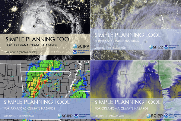
The original SPT concept was derived from exploratory workshops with emergency managers and planners in Oklahoma and Arkansas in 2017 and 2018, which were organized due to climate information requests and needs of these stakeholders. The Oklahoma and Arkansas versions of the SPT, released in 2018, were inspired by and codeveloped with these workshop participants to help meet their climate risk assessment needs. The Texas version of the SPT was launched in 2022 after receiving input from stakeholders at a regional American Planning Association conference in 2021. Finally, the Louisiana version was launched 6 months later with input from attendees at the Louisiana Resilience Summit. This resulted in four state-specific PDFs of the SPT.
This stakeholder-driven tool has been utilized by decision makers from communities of various sizes, and it has informed more than a dozen types of plans in Arkansas and Oklahoma, according to a tool evaluation study published by SCIPP’s Rachel Riley in 2021. One county emergency manager/planner serving a population of 100,000-499,999 who participated in the study’s survey said, “The SPT made it very easy to find the information I need quickly. Without it, I’m not sure I would really know where to begin.”
What’s New?
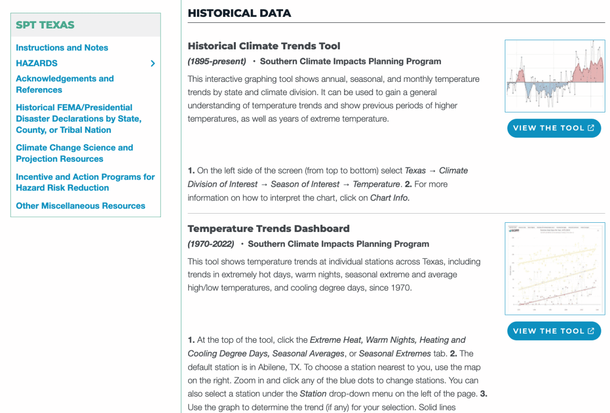
The Simple Planning Tool for Climate Hazards v2.0 is an interactive online interface with both expandable menu items throughout the page and a side menu that allow users to access the content quickly and easily. While we have combined the four tools into one, the information is still state-specific by selecting a state from the tool’s home page. Instead of several appendices with additional resources, this content is now offered as menu items, and the definition and descriptions were integrated into the hazard sections.
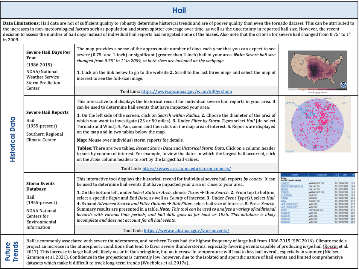
Menu items include Instructions and Notes, Hazards, Acknowledgements and References, Historical FEMA/Presidential Disaster Declarations, Climate Change Science and Projection Resources, Incentive and Action Programs for Hazard Risk Reduction, and Other Miscellaneous Resources. For each Hazard section, we provide data limitations, definition and description of the hazard, historical data tools with instructions for using the tool, a concise climate change trends summary for the hazard, and data tools with future projections (when available). This new platform will allow us to easily add new content as needed in the future.
One new feature is a “Copy Text” button on each definition and description section and climate change trends summary that allows users to copy/paste information directly into their plans. For those who prefer printed/PDF materials, a print button is also now available on the top right of the tool (after selecting a state) that provides a document of all content in the expandable menus and the URL for each tool.
The SPT is a successful example of coproduction and stakeholder-driven research, and it has evolved over time to meet the needs of our stakeholders from a range of jurisdiction sizes across the region. We will continue to update the tool periodically.
Access the SPT on our Tools page or click here.