Resources

Historic April 27, 2011 Tornado Outbreak Affects Much of the U.S.

The catastropic severe weather events that occurred yesterday, April 27, 2011, are a harsh reminder of the power of mother nature and will be remembered for generations to come. Although much information regarding the number of tornadoes, intensities, injuries, and deaths is still being documented, preliminary information (as of April 28, 2011) suggest that this […]

Historic April 27, 2011 Tornado Outbreak Affects Much of the U.S. Read More »

Texas Fires Assessed from Space

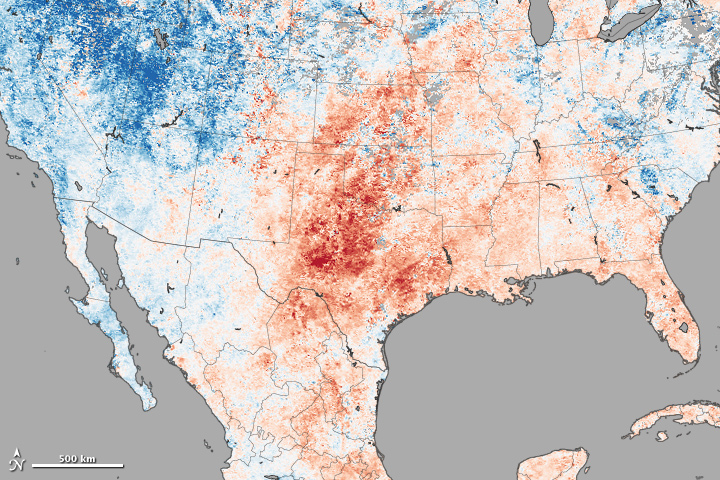
So far in 2011, more than 1.4 million acres have burned in Texas. Some 800 fires have occurred throughout the state, burning 401 structures and costing two firefighters their lives. Why is fire activity so extreme in Texas this year? This image, made with data collected by the Moderate Resolution Imaging Spectroradiometer (MODIS) on NASA’s

Texas Fires Assessed from Space Read More »

Drought Conditions Continue to Deteriorate Across the South Central U.S.

The latest weekly Drought Monitor from the National Drought Mitigation Center was released today (March 24), and it’s not a pretty picture for the south central U.S. (see image below). Though drought conditions have been occurring across portions of the south since the spring of 2010 (especially in Louisiana), drought conditions have been expanding in

Drought Conditions Continue to Deteriorate Across the South Central U.S. Read More »

Billion Dollar Disasters: 1980-2010

The National Climatic Data Center recently released updated information on billion dollar climate and weather disasters that have occurred across the United States during the past 30 years (1980-2010). The southeastern quadrant of the United States, including the entire region comprising the Southern Climate Impacts Planning Program (OK, TX, AR, LA, TN, and MS), was

Billion Dollar Disasters: 1980-2010 Read More »

New SCIPP Assessment Report on Major Disaster Declarations

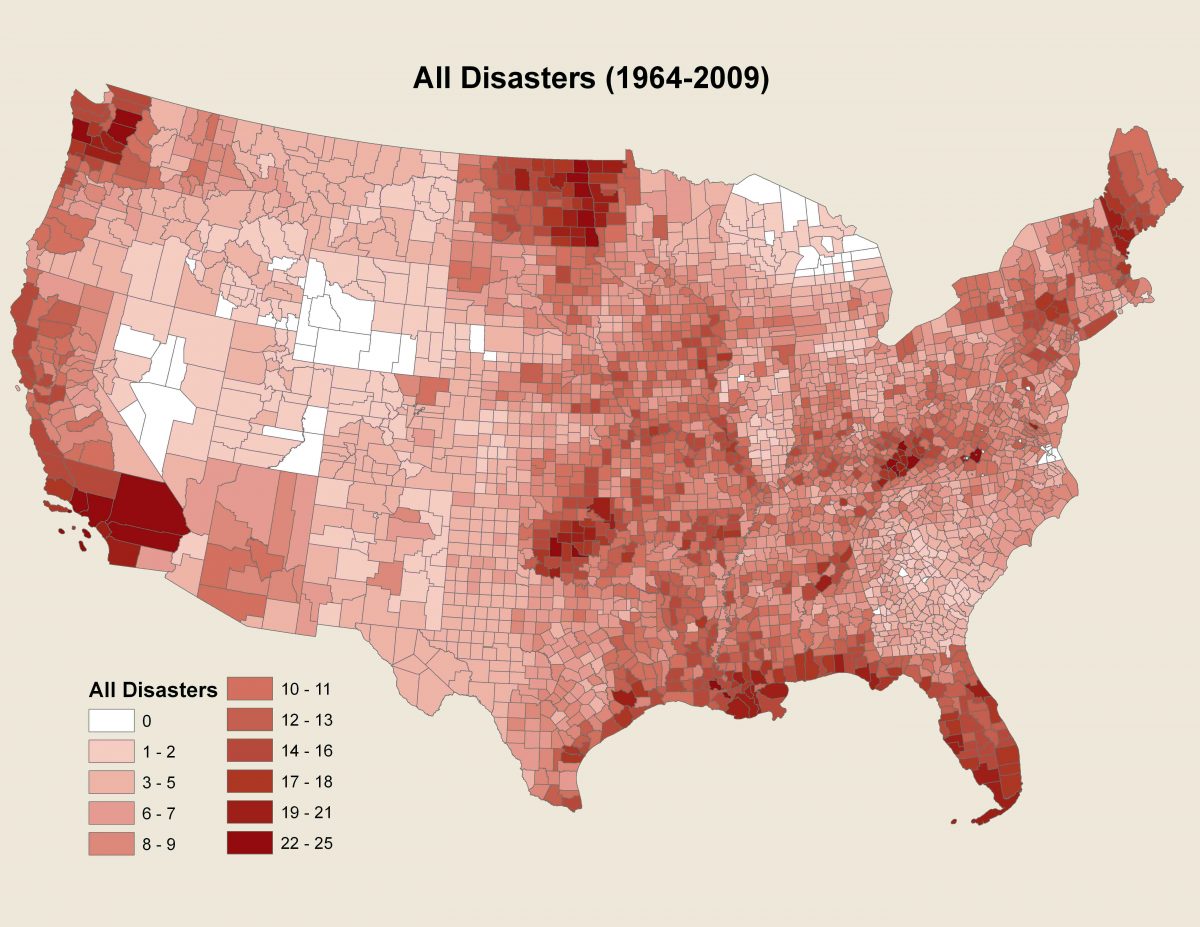
The Southern Climate Impacts Planning Program has recently completed an assessment report focused on historical disaster declarations across the United States entitled, “A Geographic Assessment of Major Disaster Declarations Across the Lower 48 States.” The purpose of the report is to quantify and visualize historical disaster declarations from the Federal Emergency Management Agency (FEMA) in

New SCIPP Assessment Report on Major Disaster Declarations Read More »

SCIPP Produces Report for the U.S. Fish and Wildlife Service

In partnership with the U.S. Fish and Wildlife Service (USFWS), the Southern Climate Impacts Planning Program (SCIPP) has recently completed a report detailing findings of a World Cafe break out session from a USFWS and U.S. Geological Survey climate change workshop held in Austin, TX. The report analyzes information that was collected during the 4-part

SCIPP Produces Report for the U.S. Fish and Wildlife Service Read More »

New Hazard Brochures Available

A series of new brochures focused on different climate hazards common across the Southern U.S. has been created and is now available in the SCIPP Documents section of our website. These new brochures include a focus on drought, hurricanes, and tornadoes. Each of the documents provide an introduction to the hazard, some information on the

New Hazard Brochures Available Read More »

Scroll to Top