Format: Fact Sheet or Brochure
Year: 2017
Authors: Kristin Calhoun
Affiliate Organizations: National Severe Storms Laboratory, Cooperative Institute for Mesoscale Meteorological Studies
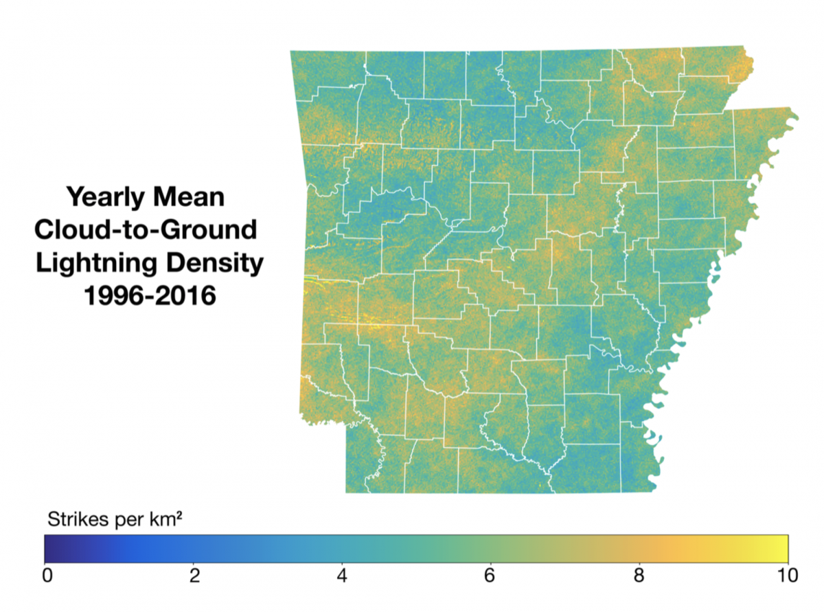
These maps were created by Kristin Calhoun (National Severe Storms Laboratory and the Cooperative Institute for Mesoscale Meteorological Studies). The maps show the mean cloud-to-ground lightning density from 1996-2016 for Arkansas for all seasons (winter, spring, summer, and fall) as well as yearly. The color scale represents the density of strikes per kilometer squared. The data have been provided by the Vaisala National Lightning Detection Network.